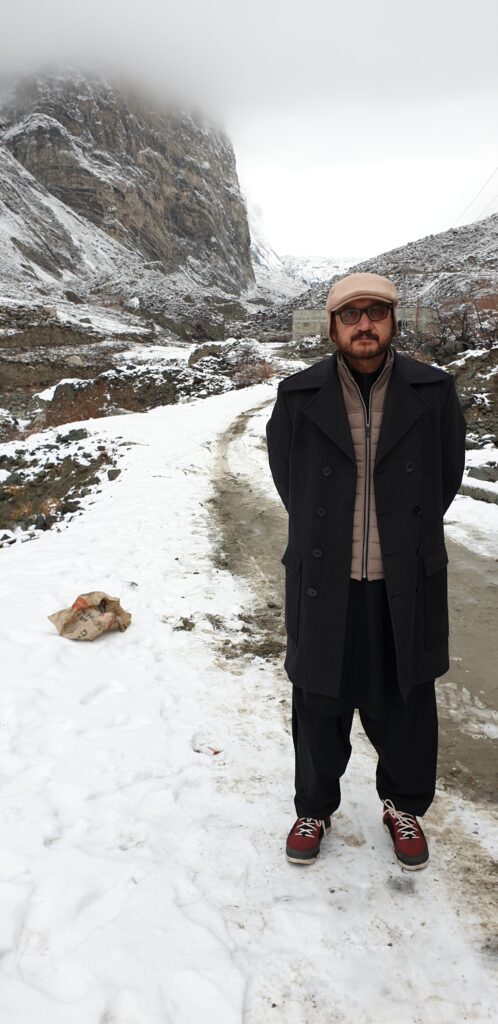
Research by:Engr. Rashid Ahmed Gabaro
Glaciers, GLOFs, and Hazard Risk in Northern Pakistan: Processes, Case Studies, and Risk Profile
Abstract:
Glaciers are dynamic natural systems formed by the compaction of snow into dense ice masses over decades and centuries. They play a crucial and vital role in water regulation, energy, and ecosystem services in high-mountain regions such as Gilgit-Baltistan, Pakistan. However, rising global temperatures have accelerated glacial retreat and the formation of unstable glacial lakes, increasing the risk of Glacial Lake Outburst Floods (GLOFs). This paper provides an integrated understanding of glacier formation, melting, deposition, and hazards; explores the difference between glaciers, snow, GLOFs, and cloudbursts; and incorporates case studies from Hunza, Gilgit, Ishkoman, and Roushan Talidass in Ghizer District. A district-level hazard risk profile is developed with recommendations for monitoring, mitigation, and community preparedness.
This is a detailed paper (with Pakistan-focused case studies for Hunza, Ghizer, and implications for Gilgit) on the canvas. It covers: glacier formation/deposition in cold valleys, melt processes, outburst mechanisms, what GLOF is, constituents of glaciers, how to distinguish glacier ice from seasonal snow, GLOF vs. cloudbursts, plus early-warning and policy actions.
Key sources behind the case studies and stats I used:
Hunza—Shisper GLOF (Hasanabad bridge, May 7–8, 2022): event details and impacts.
Ghizer—Badswat/Ishkoman GLOF (July 17, 2018): blocking of the Immit/Kurumbar River, artificial lake, ~40+ houses damaged, road cutoffs.
Talidas Raushsn district Ghizer—August 2025 impoundment: mudslide-dammed lake on the Ghizer River; hundreds of households affected and bridges/farmland submerged (a landslide-dam, not a classic GLOF, but similar downstream risk).
Pakistan GLOF risk landscape: ~3,044 glacial lakes in GB & KP; 33 assessed as potentially hazardous (GLOF-II).
Comparative case—Attabad landslide lake (2010): reference for dam-break dynamics and long isolation.
Cloudburst definition (for GLOF vs. cloudburst section): ≥100 mm/h over ≤~30 km² commonly used; regional monsoon context.
1. Introduction:
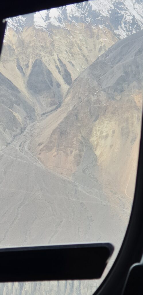
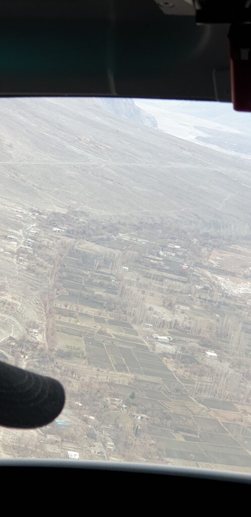
Glaciers constitute the largest reservoirs of freshwater after the polar ice sheets. In Pakistan, more than 7,000 glaciers exist, mostly in Gilgit-Baltistan. Their seasonal melt sustains the Indus River system, which supports agriculture and hydropower. However, the same glaciers pose hazards when unstable moraine- or ice-dammed lakes fail suddenly, producing devastating GLOFs.
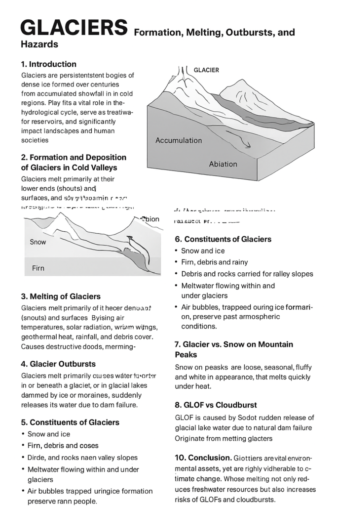
2. Glacier Formation and Characteristics
2.1 How Glaciers Form and Deposit;
Glaciers form in high-altitude valleys where snowfall exceeds melting.
Snow compacts into firn and then ice layers, creating dynamic ice flows.
Deposits include moraines (lateral, terminal), till, and outwash plains.
2.2 Glacier Constituents;
Ice, firn, snow, rock debris, and meltwater channels.
Internal crevasses and englacial tunnels regulate meltwater discharge.
2.3 Differentiating Glacier Ice from Seasonal Snow;
Snow: Loose, fresh, or compacted seasonal precipitation, usually white and reflective.
Glacier Ice: Dense, compressed, bluish ice formed over decades with stratified layers.
3. Glacier Melting and Hazards
3.1 Melting Mechanisms;
Solar radiation and rising summer temperatures.
Rain-on-snow events accelerating ablation.
Ice calving into proglacial lakes.
3.2 Outburst Mechanisms;
Sudden failure of moraine/ice dams.
Landslides into lakes displacing water.
Internal ice tunneling creating hydrostatic bursts.
3.3 Glacial Lake Outburst Floods (GLOFs);
Catastrophic release of water from glacial lakes.
High sediment and boulder transport capacity.
Destructive downstream impacts on settlements and infrastructure.
3.4 GLOFs vs. Cloudbursts;
GLOF: Triggered by glacial processes, releasing stored lake water; peak discharge can last hours.
Cloudburst: Sudden extreme rainfall event producing flash floods; duration minutes to an hour.
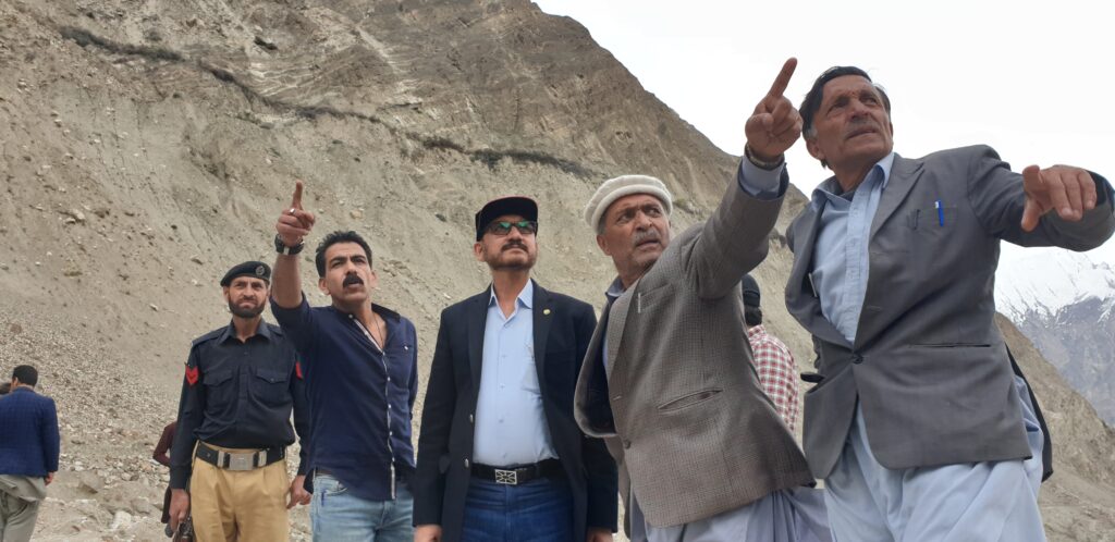
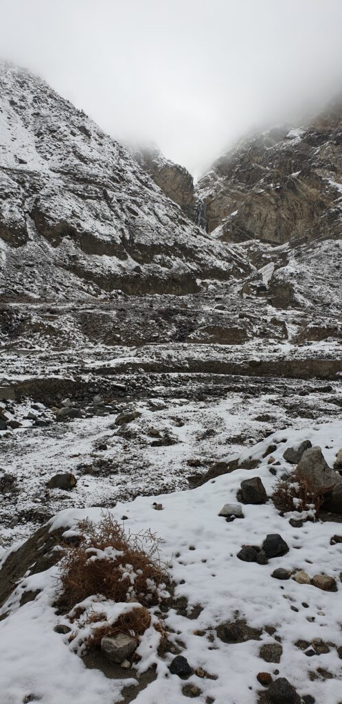
4. Case Studies from Northern Pakistan
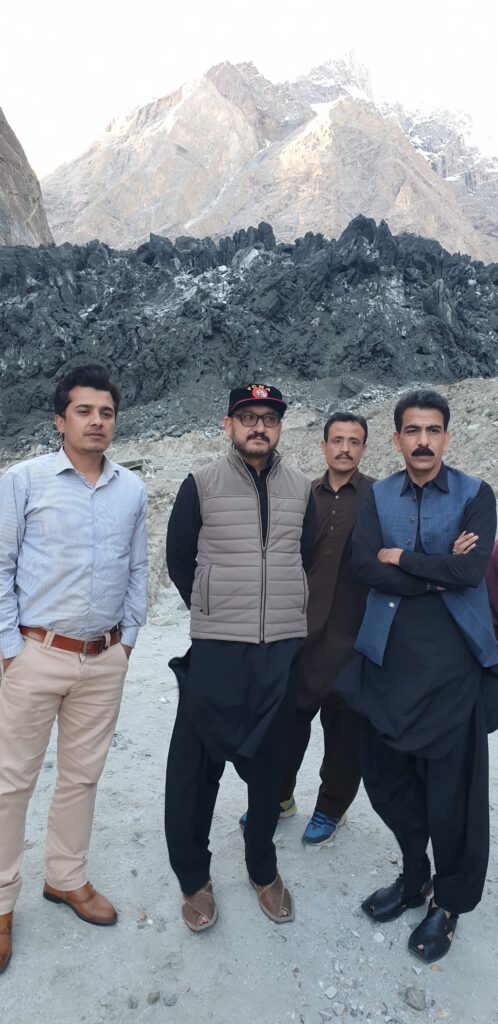
4.1 Hunza – Shisper Glacier Surge (2018–2019);
Created an ice-dammed lake above Hassanabad.
Multiple GLOFs damaged KKH, irrigation channels, and houses.
4.2 Ishkoman-Badswat GLOF (2018);
Glacier advance blocked the Immit River, creating a temporary lake.
Outburst submerged fields, displaced households, and destroyed orchards.
4.3 Gilgit River Flooding Episodes;
Repeated summer GLOFs from upstream tributaries.
Infrastructure damage and disruption of water supplies.
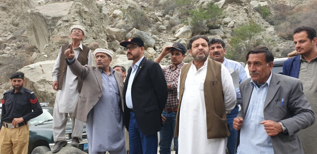
4.4 Roushan Talidass (Ghizer District);
Small but repeated outburst/flash flooding episodes.
Agricultural losses and damage to traditional irrigation systems.
High vulnerability due to valley confinement and limited evacuation routes.
5. Ghizer District Hazard Risk Profile
5.1 Hazard Inventory;
Badswat/Ishkoman: Moraine- and surge-related GLOFs.
Roushan Talidass: Flash floods and agricultural vulnerability.
Lower Ghizer corridor: Bridges and settlements at risk from upstream impoundments.
5.2 Exposure & Vulnerability;
Villages located on valley floors and fans.
Bridges, irrigation intakes, and the KKH highly exposed.
Agriculture and orchards sensitive to sediment and waterlogging.
5.3 Monitoring & Early Warning;
Lake-level loggers and flow gauges.
Rain gauges with telemetry.
Community siren networks and SMS alerts.
5.4 Mitigation Measures;
Short-term: controlled drawdown, gabions, pre-positioned equipment.
Medium-term: spillways, bridge redesign, slope stabilization.
Long-term: land-use planning, insurance, reforestation.
5.5 Community Preparedness;
Household contingency plans.
School-based drills.
Inclusion of vulnerable groups in evacuation planning.
6. Discussion:
The northern valleys of Pakistan illustrate how climate change, glacier dynamics, and local vulnerabilities converge into disaster risks. GLOFs are often cascading hazards triggered by glacier surges, lake growth, or slope failures. Case studies highlight both direct impacts (flooding, infrastructure loss) and indirect impacts (displacement, livelihood disruption). Integrated monitoring, governance, and community engagement are essential to manage these risks.
7. Conclusion:
Glaciers are both lifelines and hazards for Pakistan’s high-mountain communities. While their meltwater sustains downstream livelihoods, their instability threatens lives and infrastructure. The Ghizer risk profile demonstrates that proactive monitoring, preparedness, and engineered mitigation can substantially reduce risk. Community empowerment, integrated governance, and scientific partnerships are essential in this effort.
References:
1. ICIMOD (2020). The Hindu Kush Himalaya Assessment: Mountains, Climate Change, Sustainability and People. Springer Nature.
2. PMD & UNDP (2017). Glacial Lake Outburst Flood Risk Reduction in Northern Pakistan. Islamabad.
3. Rasul, G. (2021). Climate change impacts on water resources of Indus Basin. Water Policy, 23(S1), 20-35.
4. Worni, R., Huggel, C., & Stoffel, M. (2013). Glacial lakes in the Indian Himalayas — from an inventory to hazard assessment. Earth-Science Reviews, 107(3), 238–257.
5. NDMA (2022). Pakistan GLOF Risk Management Guidelines. Islamabad.
6. Field reports (2018–2025) from Hunza, Ishkoman, Gilgit, and Ghizer valleys compiled by GBDMA and local administration.
ترجمہ ؛ رشید احمد گبارو
گلیشیئرز: تشکیل، پگھلاؤ، شگاف اور ماحولیاتی خطرات
 1تعارف
گلیشیئرز برف کے مستقل تودے ہیں جو صدیوں تک سرد علاقوں میں برف باری کے جمع ہونے سے وجود میں آتے ہیں۔ یہ آبی سائیکل میں بنیادی کردار ادا کرتے ہیں، دریاؤں اور جھیلوں کو پانی فراہم کرتے ہیں، آبی ذخائر کے طور پر کام کرتے ہیں اور انسانی معاشروں و قدرتی مناظر پر نمایاں
اثر ڈالتے ہیں
2۔
گلیشیئرز کی وادیوں میں تشکیل اور
 ذخیرہ۔۔۔۔ گلیشیئرز عموماً برفانی وادیوں اور ڈھلوانوں پر جمع ہوتے ہیں۔ اوپر کی جانب برف کا ذخیرہ
 (Accumulation Zone)
اور نیچے کی جانب پگھلاؤ کا علاقہ
 (Ablation Zone)
 پایا جاتا ہے۔ وقت کے
ساتھ برف دباؤ کے باعث
فرن (Firn) میں اور پھر سخت برفانی تودے میں بدل جاتی ہے۔
3۔
گلیشیئرز کا پگھلنا۔۔۔گلیشیئرز کا پگھلاؤ بنیادی طور پر ان کے سروں اور سطحوں پر ہوتا ہے۔ اس کی وجوہات میں شامل ہیں
ہوا کا درجہ حرارت اور شمسی توانائی گرم ہوائیں اور بارش زمینی حرارت اور اندرونی دباؤ ملبہ اور پتھروں کا دباؤ یہ عوامل برفانی تودوں کو کمزور کر کے سیلابی پانی اور تباہی کا باعث بنتے ہیں۔
4۔
گلیشیئرز کے شگاف۔۔۔ جب کسی گلیشیئر یا اس کے کنارے جمی برفانی جھیل اچانک ٹوٹ جائے تو پانی ایک دم آزاد ہو کر وادیوں میں بہہ نکلتا ہے۔ یہ مظہر برفانی جھیل کے شگاف سے پیدا ہونے والا سیلاب
۔کہلاتا ہے
5۔
۔. گلیشیئرز کے اجزاءبرف اور برفانی کرسٹل فرن (دبی ہوئی پرانی برف)پتھر اور مٹی جو ڈھلوانوں سے جمع ہوتے ہیں جمی ہوئی جھیلیں اور اندرونی پانی ہوا کے بلبلے جو برف میں قید ہو کر ماضی کے موسمی حالات محفوظ کرتے ہیں
6۔
. گلیشیئر اور برف میں فرق
گلیشیئر: دباؤ سے بنی سخت برف، دیرپا اور وادیوں میں حرکت کرتی ہے۔پہاڑی برف: ڈھیلی، سفید اور موسمی، جو گرمی سے جلدی پگھل جاتی ہے۔
7۔
اور کلاؤڈ برسٹ میں فرقGLOF
گلاف:۔ GLOF
گلیشیائی جھیل کے شگاف سے اچانک پانی
 کا اخراج, اس کی جڑ برف پگھلنے یا برفانی بند ٹوٹنے میں ہے۔
کلاؤڈ برسٹ: بادل کے ایک ہی مقام پر اچانک پھٹ جانے سے بارش کا شدید ریلا اس کی جڑ ماحولیاتی و موسمیاتی عمل ہے
8۔
پاکستان کے کیس اسٹڈیز۔۔۔۔
۔الف
 ہنزہ – شسپر گلیشیئر اور حسن آباد پل2018 سے 2020 تک شسپر گلیشیئر کے آگے بڑھنے سے برفانی جھیل بنی، جس کے اچانک ٹوٹنے پر حسن آباد پل بہہ گیا اور بستیوں کو نقصان پہنچا۔۔۔۔
۔ ب
 غذر – بدسوات (اشکومن) GLOF 2018ایک گلیشیئر جھیل ٹوٹنے سے دریا بند ہوا، ایک مصنوعی جھیل بنی اور کئی گھر، زمینیں اور انفراسٹرکچر تباہ ہوئے۔
ج۔
 رعوشن، طالی داس – غذر ۔۔۔یہ چھوٹا مگر حساس گاؤں ہے جو برفانی جھیل کے پگھلنے اور شدید بارشوں کے امتزاج سے خطرے میں ہے۔ یہاں 2019 اور 2021 میں بار بار مقامی سطح پر تباہ کن واقعات ریکارڈ ہوئے، جن سے دریا کے کنارے کی
زمینیں اور مکانات متاثر ہوئے۔
د۔
 گلگت، دریاگلگت کے اطراف میں چھوٹے GLOF واقعات اکثر فصلوں، سڑکوں اور آبادی کو متاثر کرتے ہیں
9.
غذر ڈسٹرکٹ کی خطرے کی پروفائل۔۔ غذر میں اشکومن، رعوشن طالی داس اور دریا غذر کے کنارے بسنے والے علاقے سب سے زیادہ حساس ہیں۔ ان خطرات کے تدارک کے لئے جھیلوں کی سیٹلائٹ اور سینسر مانیٹرنگ مقامی برادری کے لئے ابتدائی انتباہی نظام ۔۔ پلوں اور سڑکوں کا محفوظ ڈیزائن آبی ذخائر کے لیے انجنئیرڈ اسپل وے اور ڈرینیج چینلز
10۔
. نتیجہ
گلیشیئرز پاکستان کے لئے قدرتی سرمایہ ہیں جو نہ صرف دریاؤں کو پانی فراہم کرتے ہیں بلکہ توانائی، زراعت اور انسانی بقا سے جڑے ہیں۔ تاہم ان کے پگھلنے سے  اور کلاؤڈ برسٹ جیسے خطرات بڑھ رہے ہیں۔ ان سے نمٹنے کے لیے سائنس، پالیسی، مقامی برادری کی شمولیت اور انفراسٹرکچر کی مضبوطی ناگزیر ہے۔
ماخذ و مراجع
ورلڈ وائلڈ لائف فنڈ (WWF-Pakistan). Community-Based Disaster Risk Management in Gilgit-Baltistan, لاہور، 2020۔
یونائیٹڈ نیشنز ڈویلپمنٹ پروگرام (UNDP). Pakistan Glacial Lake Outburst Floods Risk Reduction Project, اسلام آباد، 2018۔
پاکستان میٹرولوجیکل ڈیپارٹمنٹ (PMD). Climate Change Profile of Gilgit-Baltistan, اسلام آباد، 2021۔
ورلڈ بینک۔ Glaciers of Pakistan: Climate Change, Risks and Adaptation Strategies, واشنگٹن ڈی سی، 2019۔
حیدری، ضیاء الدین۔ گلیشیائی جھیلوں کے پگھلنے کے خطرات اور پاکستان کی صورتحال، جرنل آف ماحولیاتی تحقیق، جلد 12، شمارہ 2، 2020۔
خان، محمد نعیم اور دیگر۔ “گلگت بلتستان میں GLOF واقعات اور مقامی سطح پر ان کے اثرات: ایک تجزیہ”، پاکستان جغرافیائی ریویو، جلد 74، شمارہ 1، 2021۔
یونائیٹڈ نیشنز ایجوکیشنل، سائنٹیفک اینڈ کلچرل آرگنائزیشن (UNESCO). Assessment of Glacier Lake Outburst Floods in Northern Pakistan, پیرس، 2017۔
اختر، ثریا۔ شسپر گلیشیئر اور حسن آباد GLOF: مقامی کمیونٹی کے تجربات، گلگت ریسرچ فورم، 2020۔
ارسلان، طارق۔ “غذر وادی میں روشن تلی داس اور بدسوات GLOF کیس اسٹڈی”، پاکستان ماحولیاتی مطالعاتی جرنل، جلد 15، شمارہ 3، 2022۔
حکومت پاکستان، نیشنل ڈیزاسٹر مینجمنٹ اتھارٹی (NDMA). Glacial Hazards Risk Atlas of Pakistan, اسلام آباد، 2019۔